
Walk a LaPlace Street by Address
A sound street search begins with place, not a person. LaPlace is an unincorporated community in St. John the Baptist Parish, so parish and state offices hold the useful records. First standardize the street line. Then use the assessor and GIS to fix the parcel in the right jurisdiction. A parcel is the land unit used for assessment. It is not the same as a household.
Preserve the address exactly as each source shows it. “W. Airline Hwy.” and “West Airline Highway” may refer to the same road, while LA-51, Highway 51, and local aliases may index in different ways. A unit, lot, or mobile-home detail can sit in an “Other” field. Search the street number and its most distinct word when the full line fails.
- Check the address with USPS, keeping the original wording and standardized result.
- Search the St. John Parish Assessor by physical street number and street name.
- Open GIS, locate the parcel polygon, and note its parcel or map number.
- Use the owner and legal description to search the Clerk’s land index.
- Consult voter, permit, code, and dated directory sources only for their narrow roles.
This sequence leads the LaPlace street directory because it limits false matches. One parcel result never proves that no other address exists along the road.
Search LaPlace Assessor Street Fields
The St. John Parish Assessor property search accepts address and identifier fields. No historical roll start was posted. Treat it as a current search shell, and ask whether archived cards or prior rolls are available. Results may distinguish physical address from owner mailing address. Tax mail can go outside LaPlace and does not prove where an owner lives.
| Search control | Use | Street value |
|---|---|---|
| Assessment No. | Exact assessment identifier | Returns to a known parcel |
| Parcel Mapping Number | Map or parcel identifier | Bridges GIS and assessment |
| Owner | Last, first, or business | Checks owner after address search |
| Physical Street No. | Situs number | Narrows repeated names |
| Physical Street Name | Distinct name and variants | Supports by-street searching |
| Other Physical Street | Unit, lot, or extra text | Finds secondary details |
The fields appear in the captured assessor search screen.
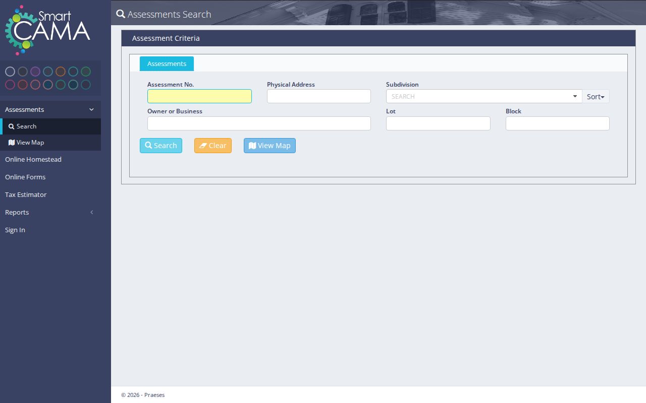
The form supports a controlled address search without promising that each possible result column is filled for every parcel.
LaPlace Records Indexed by Street
No public list identifies every person on a LaPlace street. Each source records a legal, tax, civic, or administrative link. Keep the date and exact role attached to every name.
| Source | Keeper | What it establishes | Access |
|---|---|---|---|
| Assessment roll | Parish Assessor | Parcel, owner display, physical and mailing fields | Web search or office |
| GIS layers | Parish GIS | Roads, parcels, flood, zoning, precinct, council district | Public viewer |
| Deeds and plats | Clerk of Court | Recorded parties, legal description, prior references | eClerks or office |
| Tax bills | Tax payment system | Bill tied to parcel, name, notice, or address | Public search |
| Voter address route | Secretary of State | Address and precinct civic result | Free portal |
| Permit and code files | Planning and Zoning | Project or violation history if released | Account, counter, request |
The chain is address to parcel, parcel to legal description, and legal description to instrument. Never merge a tax recipient, deed party, and directory occupant into “resident” without proof.
Map LaPlace Streets in GIS
The parish GIS page lists aerials, streets, addresses, parcels, flood zones, precincts, zoning, and council districts. Browse a road segment, then click or use Feature Data for nearby parcels. Save parcel IDs rather than private owner details. Roads, canals, and district lines explain why close addresses can follow different civic paths.
A GIS polygon is an assessment and location aid, not a legal survey. Read the recorded deed and plat when a line matters. The parish announced a move to GeoSync beginning March 1, 2026. Its preview carried an accuracy warning, so retain both viewer URLs during the transition.
Insider tip. Carry the parcel mapping number from GIS into the deed search instead of starting with a common owner name.
Follow LaPlace Street Deed Chains
The St. John Parish Clerk land-record page identifies the Clerk as keeper of conveyance and mortgage records. Its local Real Estate Transfers search is no longer active. Use eClerks or the Clerk’s office. Statewide discovery can be free, but images may require a subscription or purchase. The exact St. John online index and image cutoff was not published.
Search current and prior owners as both grantor and grantee. A grantor transfers an interest; a grantee receives it. Read the image for document type, recording date, instrument number, lot, block, subdivision, and prior deed reference. Successions, donations, corrections, releases, and plats can interrupt a simple sale chain.
The Clerk access route appears in this capture.
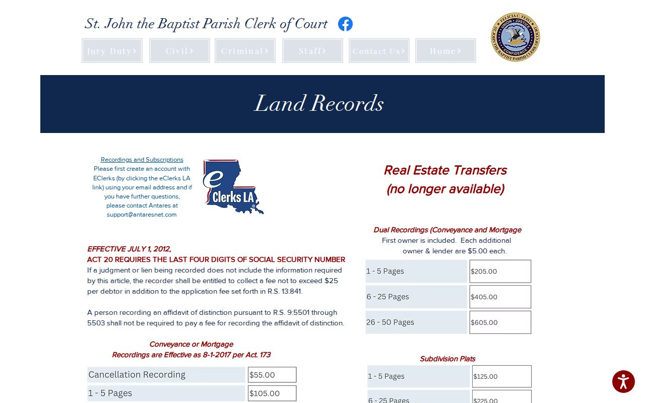
The screen is an access point, not proof of full online coverage. Ask the Clerk for book ranges and certified-copy terms.
Check LaPlace Streets in Tax Records
The St. John tax payment search offers Notice or Bill number, Parcel number, Taxpayer Name, Address, and Tax Year controls. Its tips allow a street number with the first street word, or the street alone. This can find a bill when spelling differs, but it does not establish title, occupancy, or a boundary.
The modes are visible in the captured tax search.
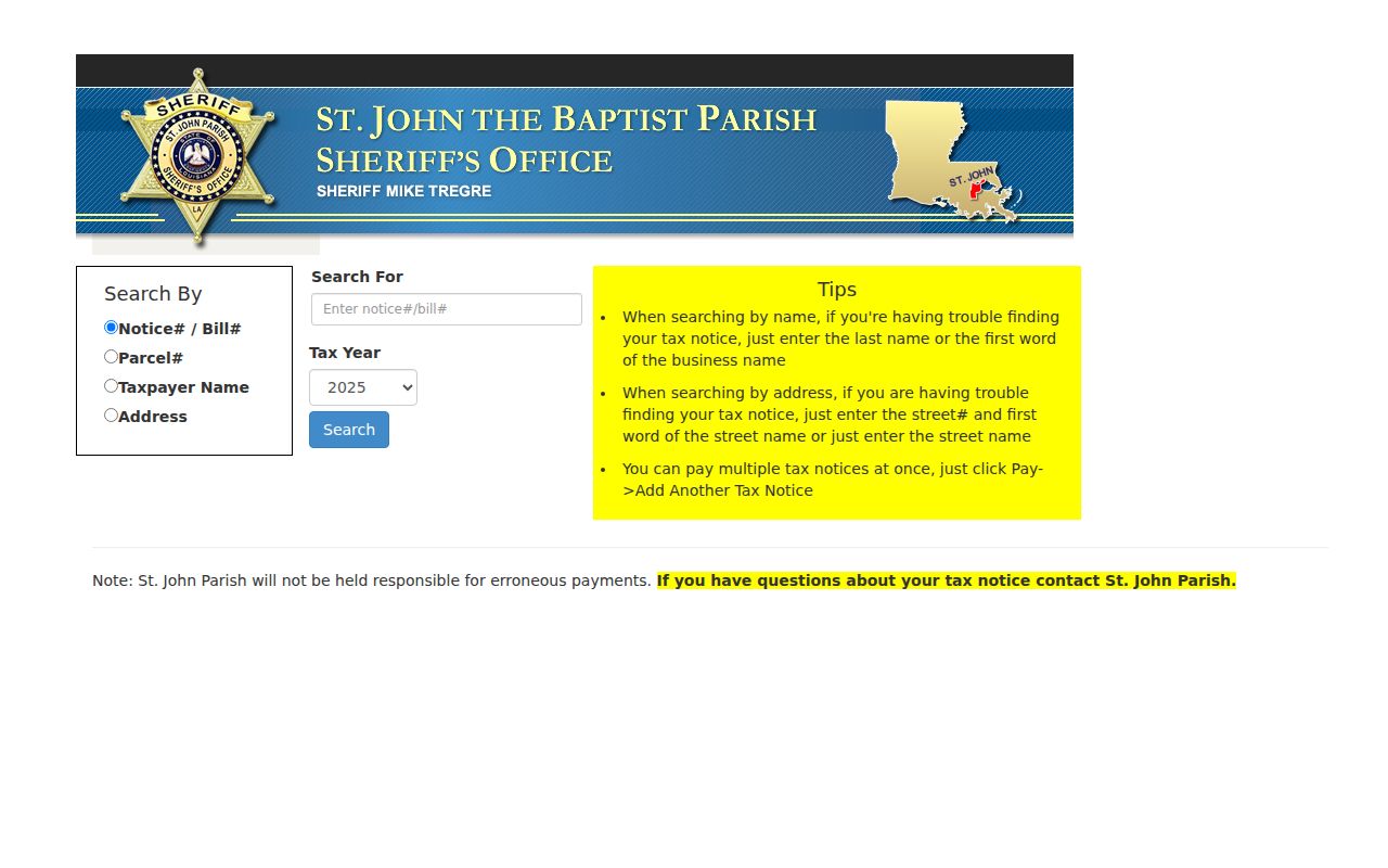
Use a matching notice as one check, then return to the assessor and deed image for land details.
Normalize LaPlace Street Names Carefully
The USPS ZIP lookup standardizes a street, unit, city, state, and ZIP. USPS warns that a result does not confirm a person or company there. Keep the postal result beside the original deed or directory string.
- Parcel
- The land unit used for assessment and mapping.
- Situs address
- The physical parcel location, distinct from tax mailing address.
- Plat
- A recorded drawing of lots, blocks, and subdivision layout.
- Criss-cross directory
- A dated directory arranged by street or phone instead of only surname.
A LaPlace mailing label needs a parish check. Historical state material lists Montz in St. Charles Parish with LaPlace and ZIP 70068. Match parcel map, parish, and legal description before using any street-directory result.
Request LaPlace Address Case Files
Planning and Zoning lists permits for signs, private streets, demolition, land disturbance, mobile homes, culverts, excavation, occupancy, zoning checks, subdivisions, and variances. Applications use MGO Connect or the office at 1811 W. Airline Highway. No public address case index was found, and submission is not complete until staff review.
For code history, email code@stjohn-la.gov or call 985-359-1195 with the address. The parish describes inspection, notice, cure, abatement, and possible lien stages, with a typical one-to-two-week response for a summary. If no index exists, use the parish public-record request form.
Read Older LaPlace Street Listings
Historical directories can link a name with an address in one year, but no complete LaPlace residential run was found. Ask the parish library, State Library, and Library of Congress for exact titles and years. The 2018 State Government Telephone Directory has a LaPlace agency section, not a private household roll.
Older German Coast records may use a church parish, plantation, or River Road place instead of a modern street. Preserve that label, then bridge it with deeds, maps, postal tables, and GIS. Collection details belong on the LaPlace city directories page; an old entry is never proof of current residence.
Use LaPlace Voter Tools Narrowly
The Louisiana voter address lookup asks for ZIP, address, optional apartment or lot, and city. It serves precinct and civic routing, not a full household roster. A no-match may reflect spelling, update lag, protected status, or the limited form.
Louisiana law protects specified application data. The Address Confidentiality Program gives eligible relocated survivors a substitute address. Never reverse it through maps, deeds, or adjacent parcels. Contact the LaPlace Registrar for a correction or registration question.
Note: A voter result, tax mailing address, and dated directory line are leads, not automatic proof of current residence.
Limits of a LaPlace Street Directory
Public sources do not list every renter, child, household member, delivery customer, utility customer, or unindexed occupant. The assessor shows assessment roles. The Clerk records instruments. Voter tools serve elections. Historical directories freeze one year. Each can be correct in its role and still not answer who is present today.
A blank can result from an alias, unit stored elsewhere, nearby parish, portal gap, or protected record. Record the date, source, spelling, and channel. Then try the office, request form, library, or archive rather than calling an online non-result proof of absence.
The offline route depends on the record. The Clerk has an eastbank office in the New Government Complex at 1811 W. Airline Highway in LaPlace and a westbank office at the Edgard Courthouse. Land books, image coverage, plats, and certified copies should be addressed to the Clerk. Assessor questions belong with the St. John Parish Assessor. Planning and code histories go to their parish departments. A narrow request should name the address, likely date span, and record type rather than ask for every file about a street.
Older land research may leave the current portals entirely. The State Archives identifies St. John Original Acts from 1753 through 1798, including property sales, successions, civil suits, and other matters. Its microfilm guide says Clerk permission is required because the Clerk remains custodian. Those acts can support early German Coast land research, but historic place labels must be bridged forward through later conveyances. They should not be forced into a modern address without a documented chain.
Lawful use. Use LaPlace street records for family, property, civic, or historical research. Never use them to monitor, stalk, harass, intimidate, or expose anyone.